
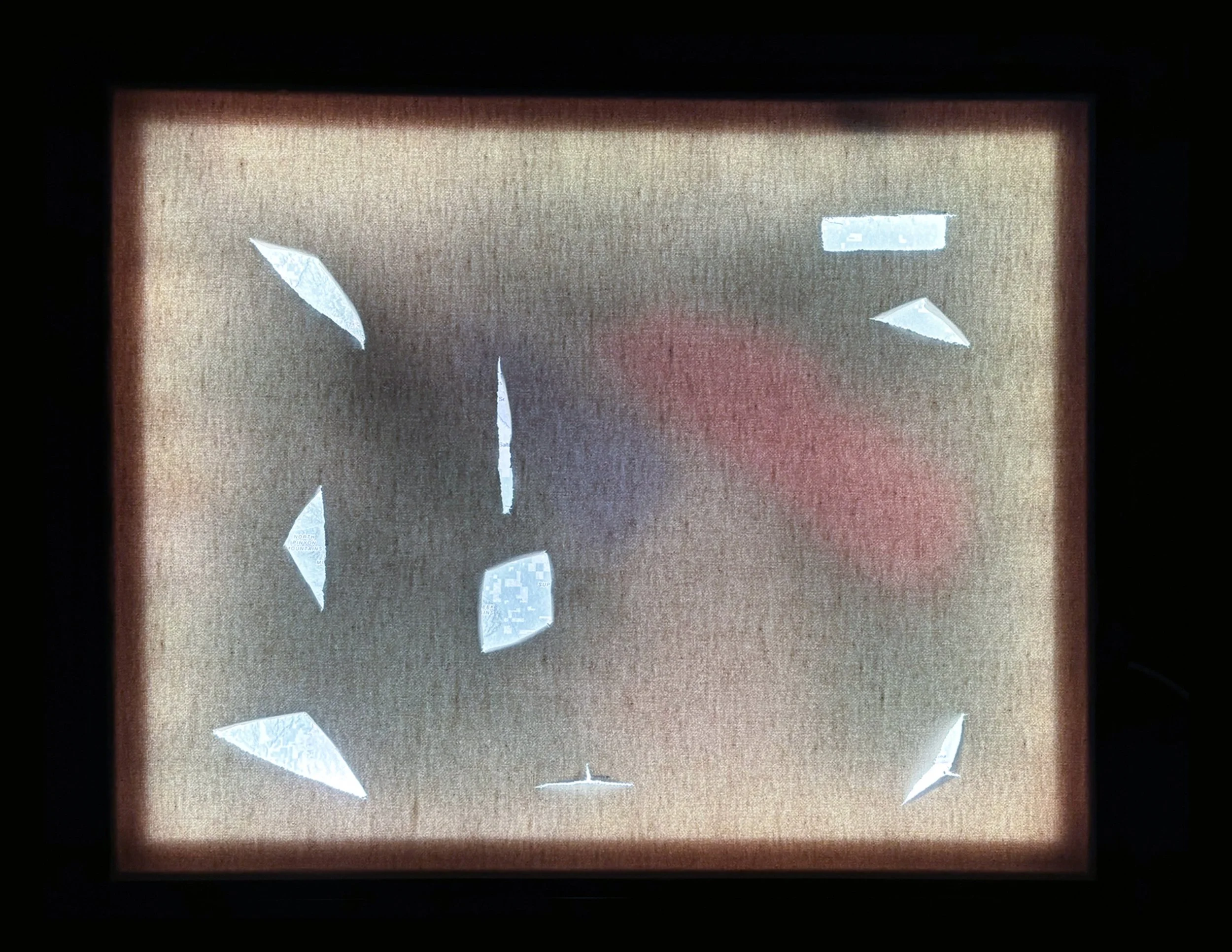
Fatal Cartography
This mixed-media piece explores the contested relationship between natural landscapes with human development patterns, providing a comparison between the sculpture of land over geological time with the rapid, manipulative forces of urban sprawl and industrial exploitation. Behind the canvas, mapped data displaying landfills, closed lands, and conservation lands, are obscured, limiting visibility and highlighting our fractured relationship with these spaces. The light element focuses on both the physical incisions on the canvas and the obscured cartography beneath, provides reflection on the erasure of contested landscapes.
Field Journal
The contrast between the open desert, abundant in land, with the development patterns of contemporary cities, where urban sprawl and landscape degradation manipulate the land, impact the natural landscapes sculpted by natural processes following millions of years of gradual change.
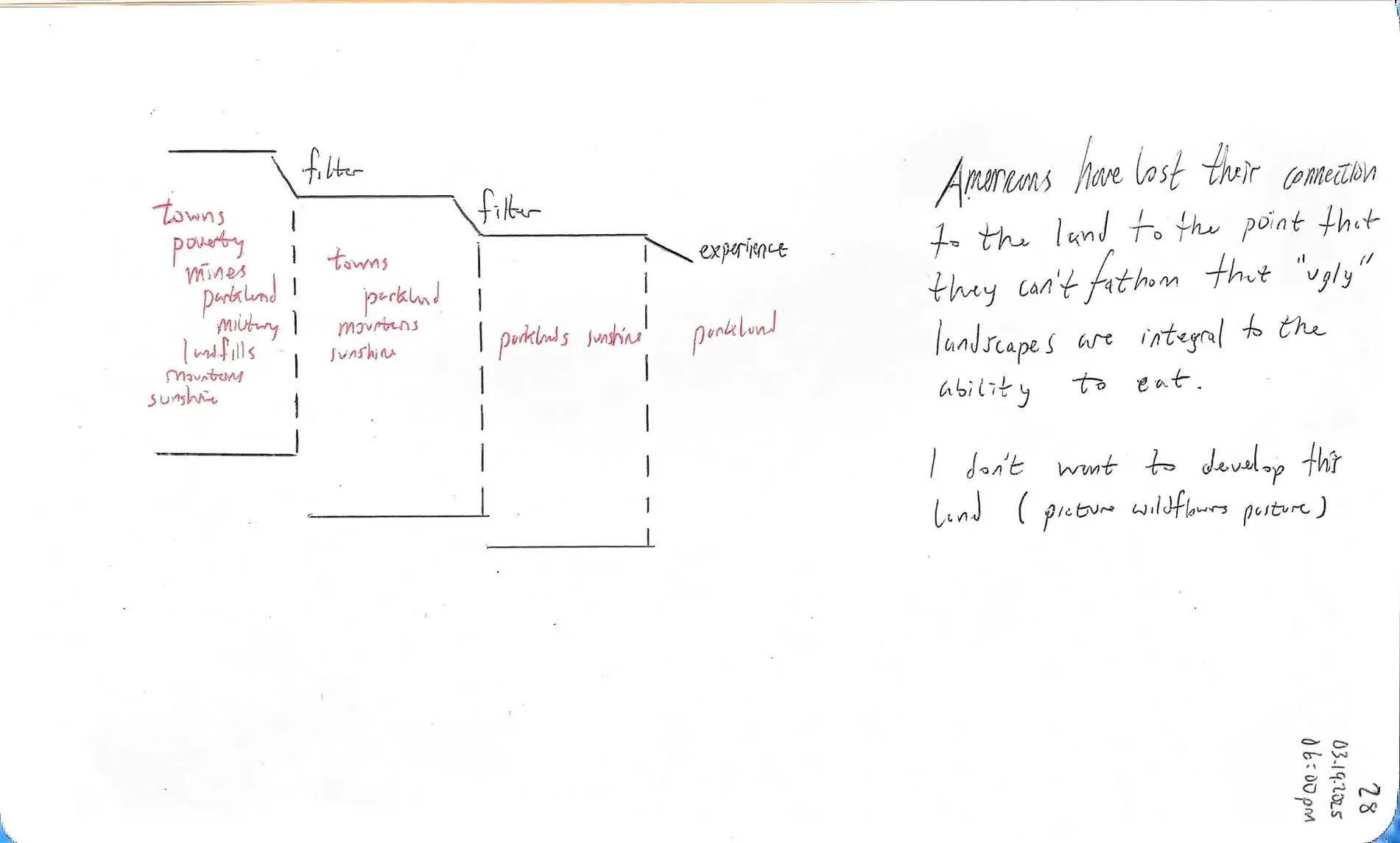
This schism provides a window into the temporal scale of development between the forces that sculpt the land with the forces that manipulate the land. This window provides the context to understand how land is developed and how land is valued when it is far removed from the physical tendrils of sprawling urban development.
Without context, the desert landscape appears to be one of emptiness, devoid of life but this landscape is a complex ecosystem from the flora and fauna to the water systems that shape the land, yet the sprawl and industrial demand leave a lasting impact.
These demands include the garbage waste of Los Angeles County shuttled by freight train to a former mine for eradication (the garbage is sent into the catacombs for the future generations to uncover); military bombing ranges that reign terror on everlasting mountain ranges in preparation for war; the historiography of the land rapidly has shifted from the sculpted natural hand towards the dagger of technological dominance.
Conceptual Background
-
![]()
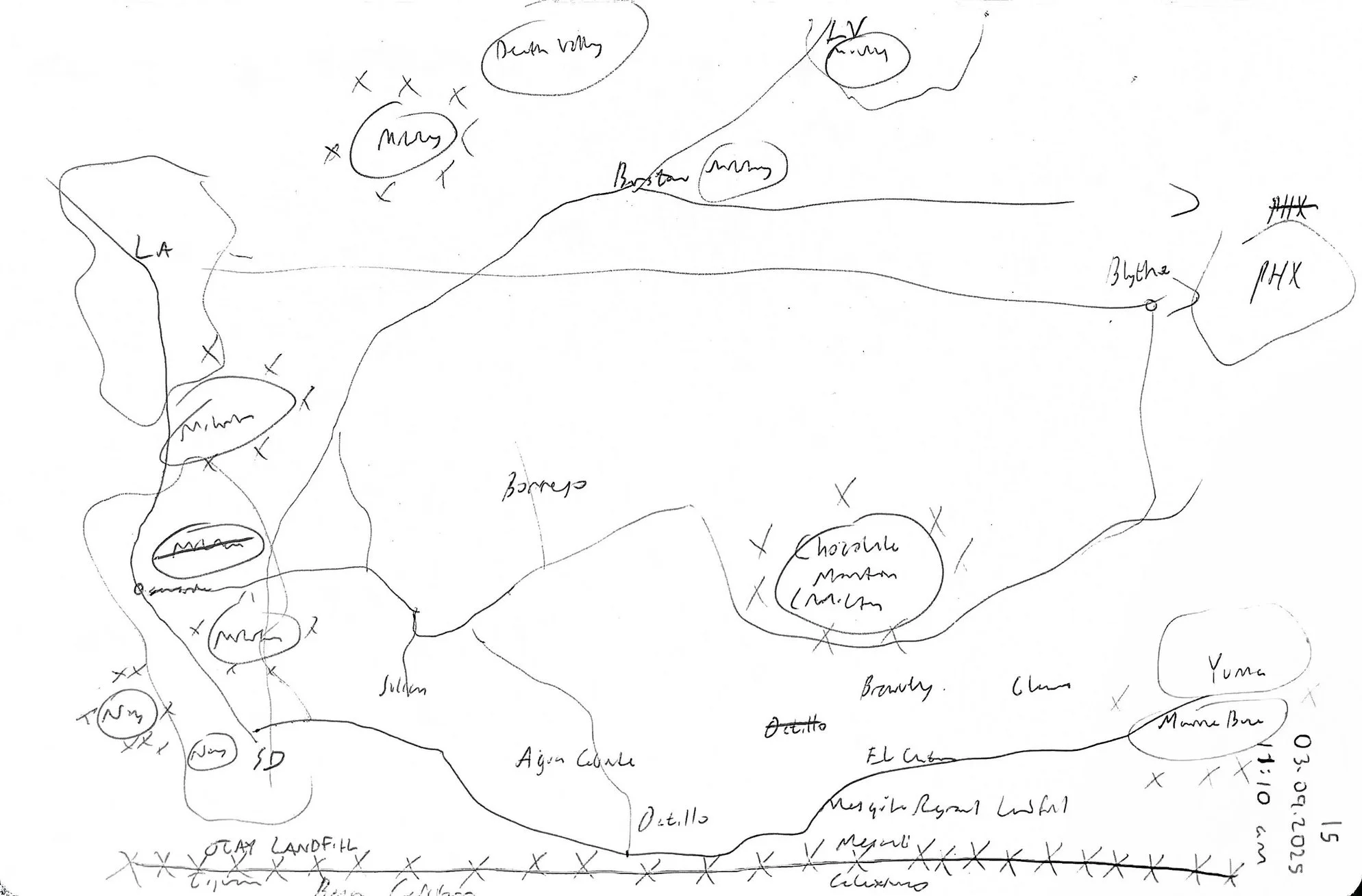
Mental Map
-
![]()
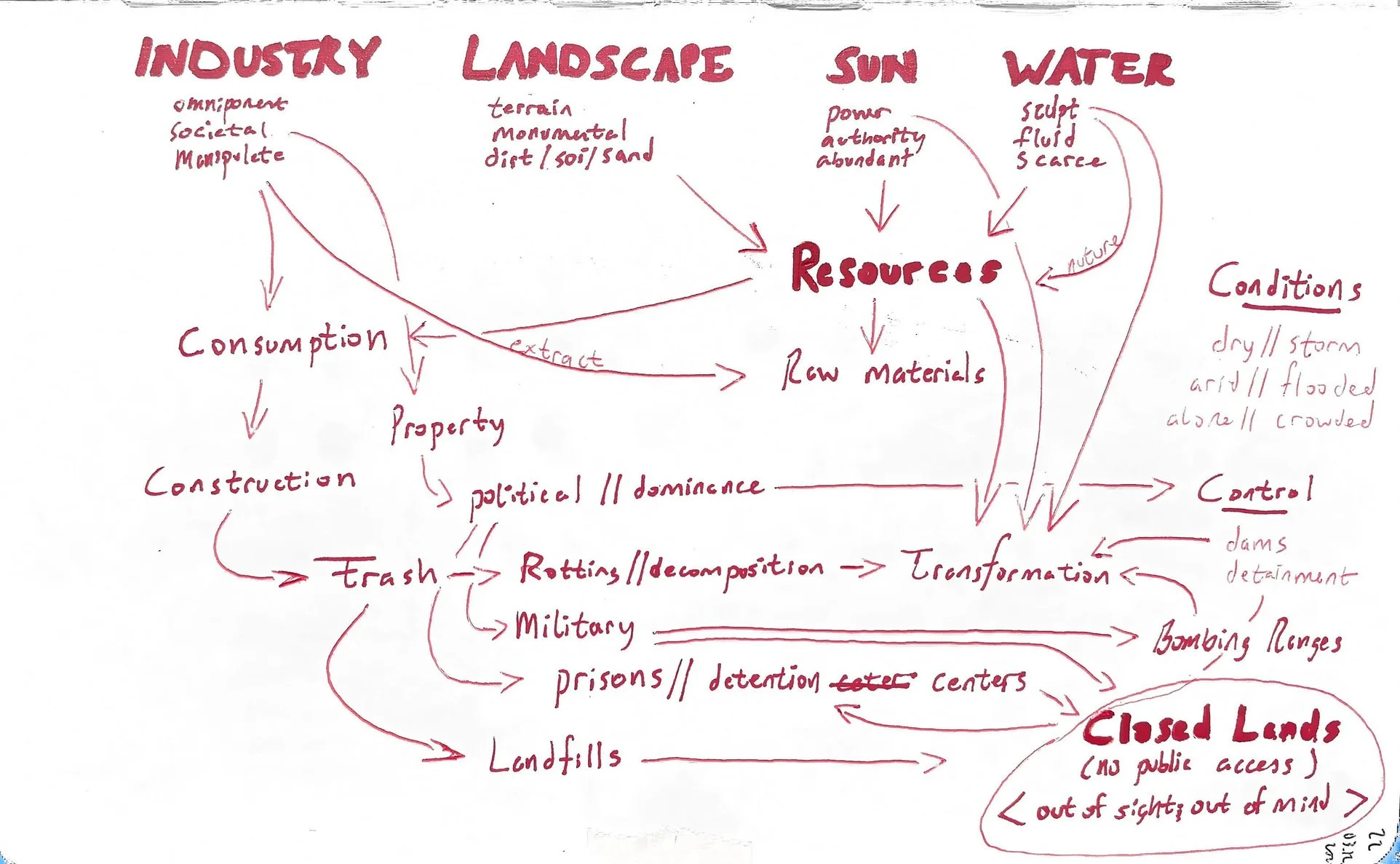
Concept Diagram
-
![]()
Content Filter
Process and Creation
This piece is a mixed-media presentation that began with computer-based applications, including QGIS and Adobe Illustrator, combined with a physical canvas to create tactile dimensionality to the computer-produced map.
The initial computer-based work included researching relevant data, including reclassifying the information within the dataset to provide a legible presentation (e.g. translating provided land use data from hundreds of oblique land use categories to a coherent number of land use categories with clear titles); editing polygons in QGIS to clean up transitions between datasets (e.g. the conservation lands between San Diego and Imperial Counties are created by different governmental entities, requiring clean-up at the polygon boundaries); and selecting relevant data from larger datasets (i.e. selecting parcels that overlap with data on active mines and landfills out of the thousands of parcels across both San Diego and Imperial Counties) to include on the computer-produced map. Following these processes, Adobe Illustrator is used to clean up the initial map file.
Following the data preparation process, the map was created on the computer then transferred to tangible form. The printed map was placed behind a physical canvas, wherein strategically placed slash marks were applied to the canvas as a critique the contentious, alienated relationship between human systems of control and natural landscape systems.
Basemap detailing the desert landscape inundated with industry far removed the eyes of populated areas.